
Case Studies : Carbon Credit Creation through Forest Measurement and Management, Hinohara Village, Tokyo, Japan
Visualizing the value of a forest to create Japan's first forest-derived voluntary carbon credits Turning forest conservation into a sustainable business through forest measurement and natural capital assessment
Carbon
Working with iforest Inc., Biome Inc., Tokyo Tatemono Co., Ltd., the Urban Institute, Kyushu University, and the Natural Capital Credit Consortium (NCCC), Yamaha Motor carried out a forest restoration and conservation project in Hinohara Village, Tokyo, Japan. Across approximately 17 hectares of forest, we used LiDAR mounted on an industrial unmanned helicopter to visualize the forest's CO₂ absorption and forest structure in high detail.
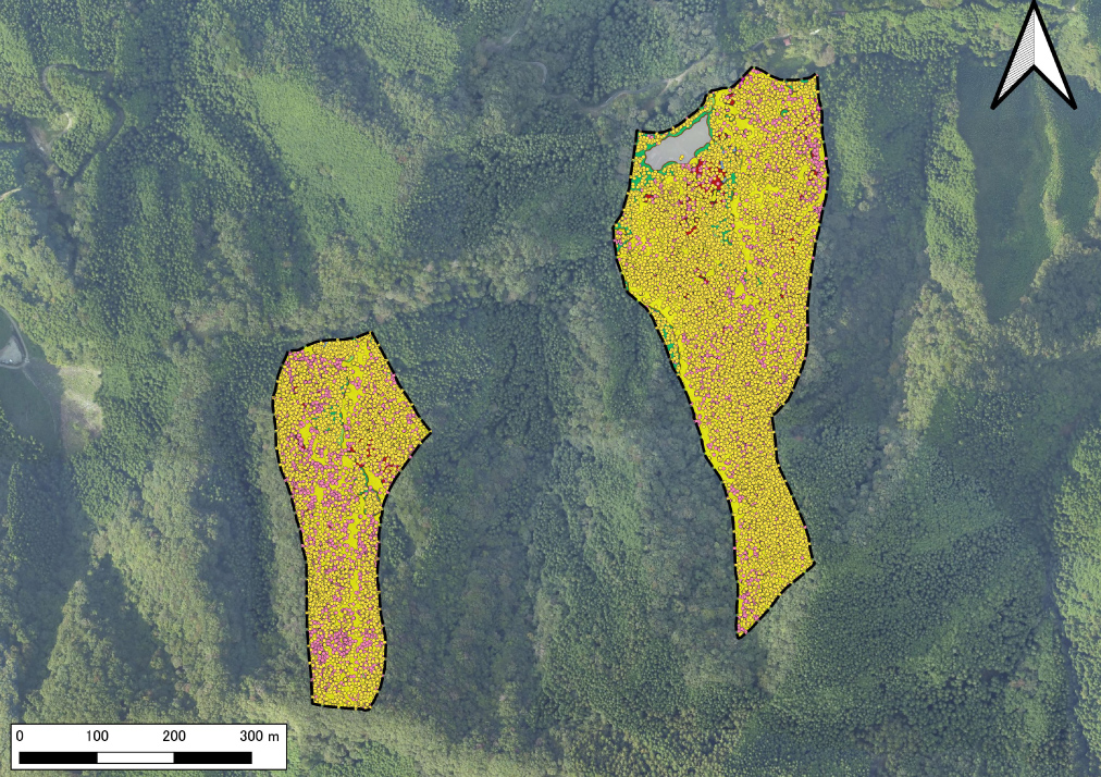
Analysis results showing individual tree attributes and tree species classification, overlaid on an aerial photograph of Hinohara Village (Geospatial Information Authority of Japan).
This is the first project in Japan to combine UAV LiDAR, satellite data, and biodiversity assessment in a forest-derived voluntary carbon credit, and to carry it through every stage—methodology development, certification, credit issuance, and sale. The model quantifies not only the carbon removed by the forest but also its biodiversity and wider natural capital value.
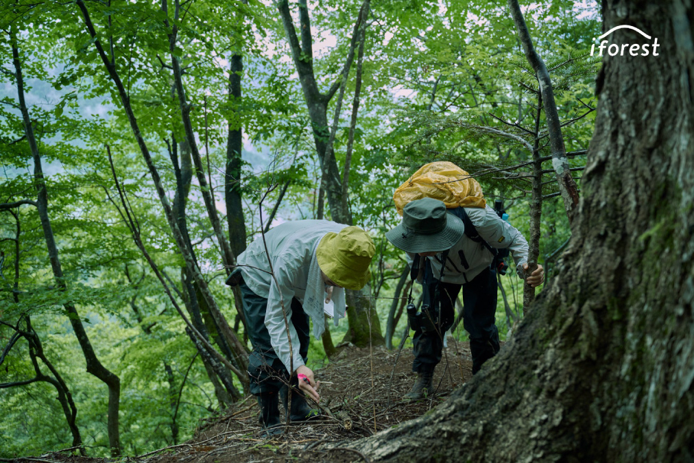
Forests are a significant natural capital asset for CO₂ absorption, yet timber revenue alone is becoming insufficient to sustain forest management and conservation activities. The environmental value of forests and the ecosystem services they provide are not adequately converted into economic value, and a new revenue model is needed to support forest management activities.
In this project, laser scanning and satellite data analysis scientifically visualize forest condition and CO₂ absorption. The results are then traded on the voluntary market as carbon credits, with proceeds returned to forest conservation as a new funding source.
Credit purchases by companies generate new income for forest owners and the local community, building a sustainable cycle that supports proper forest management, biodiversity conservation, and the transition to a decarbonized society.
INDEX
- Background & ChallengeMechanisms to assess the environmental value of forests accurately and turn it into sustainable revenue are insufficient
- Yamaha Motor's ApproachVisualizing forest value through high-accuracy UAV LiDAR forest measurement
- ResultsJapan’s first model for creating, certifying, and selling forest voluntary carbon credits
- Conclusion
Background & Challenge
Mechanisms to assess the environmental value of forests accurately and turn it into sustainable revenue are insufficient
Japan is a heavily forested country, but a shortage of forestry workers and rising management costs mean that appropriate management is becoming difficult in many forests. Expectations for carbon credits based on the CO₂ absorption capacity of forests have grown; establishing accurate forest measurement and a reliable assessment method has been the challenge.
Four limitations of conventional methods
- Forest resources are difficult to measure accurately
- The measurement and certification costs required to create forest credits are high
- Mechanisms for assessing the multiple values of forests, including biodiversity, remain insufficient
- Economic incentives for long-term forest conservation remain insufficient
The project needed a way to capture forest structure and CO₂ absorption accurately and efficiently, quantify the forest's environmental value scientifically, and convert that value into a tradable form—a carbon credit.
Yamaha Motor's Approach
Visualizing forest value through high-accuracy UAV LiDAR forest measurement
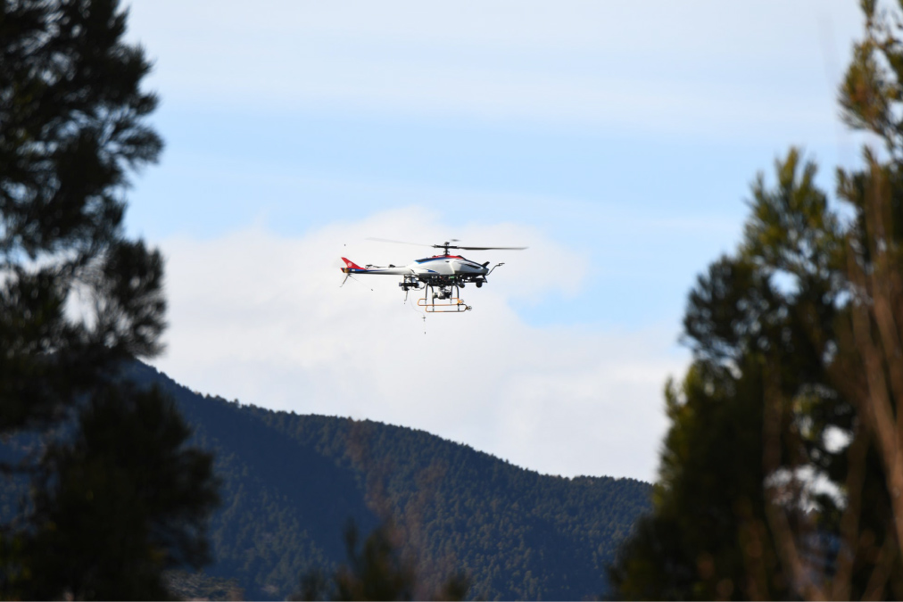
Yamaha Motor surveyed the forest in Hinohara Village, Tokyo, using LiDAR mounted on an industrial unmanned helicopter. Because laser pulses can penetrate the canopy and reach individual tree stems—which are difficult to capture with standard drone or satellite imagery—the system can accurately reconstruct tree height, diameter at breast height (DBH), and forest structure.
The data were analyzed alongside satellite data and biodiversity records and served as the basis for estimating forest biomass and projecting future CO₂ absorption.
Approach & Method
01High-accuracy forest resource measurement with UAV LiDAR
We conducted LiDAR surveys from an industrial unmanned helicopter to capture the forest's internal structure in three dimensions. This allowed accurate measurement of tree height and stem diameter, and enabled forest resource volume to be assessed more accurately than with conventional methods.
02Building a high-accuracy MRV system with satellite data
Alongside the LiDAR data, we used satellite data including Sentinel-2 and MODIS. Together, these form a Measurement, Reporting and Verification (MRV) framework that allows forest biomass and carbon stock to be monitored continuously, making forest assessment both accurate and efficient.
03Integrated assessment of biodiversity and natural capital value
Beyond CO₂ absorption, we analyzed species observation records together with forest structure and layering to quantify biodiversity and natural capital value. By visualizing the environmental value of the forest from several angles, we built a new model for valuing forests.
04From methodology development through to certification
The joint research team developed a new methodology for forest-based carbon credits. Actual credits were then certified and issued through the NCCC Carbon Standard certification process.
Results
Japan’s first model for creating, certifying, and selling forest voluntary carbon credits
Across approximately 17 hectares of forest in Hinohara Village, we combined high-accuracy forest measurement with natural capital assessment, and the resulting forest-based carbon credits were certified and issued.
This is the first project in Japan in which UAV LiDAR, satellite data, and biodiversity assessment have been integrated into a forest-based voluntary carbon credit project and taken all the way from methodology development to certification and issuance.
The introduction of Yamaha Motor's laser scanning technology also allowed forest biomass and forest structure to be determined accurately, improving both the accuracy and efficiency of the MRV required for forest credit creation.
Conclusion
LiDAR surveying from Yamaha Motor's industrial unmanned helicopter made Hinohara Village's forest resources visible in detail. By quantifying not only CO₂ absorption but also biodiversity and natural capital value, the project established a new model for valuing forests.
As Japan's first forest-based carbon credits project to integrate UAV LiDAR, satellite data, and biodiversity assessment from methodology development through certification and issuance, it demonstrates a new market mechanism capable of supporting forest conservation. It treats the forest not only as a “timber resource” but as an “asset that generates environmental value”—a leading example of sustainable forest management that advances decarbonization, nature positive, and regional revitalization at the same time.
 Contact us
