Aero Sensing Services
Yamaha Motor offers advanced laser surveying using industrial unmanned helicopters, enabling the acquisition of highly accurate topographic and forest data.
Features
Yamaha Motor’s Aero Sensing Services enable detailed observation of forest interiors through aerial measurements.
By digitizing forest structures and terrain features, we enhance the intrinsic value of forests and contribute to the realization of a society
where humans and nature live in sustainable balance.
FEATURE 01
Forest Structure Mapping
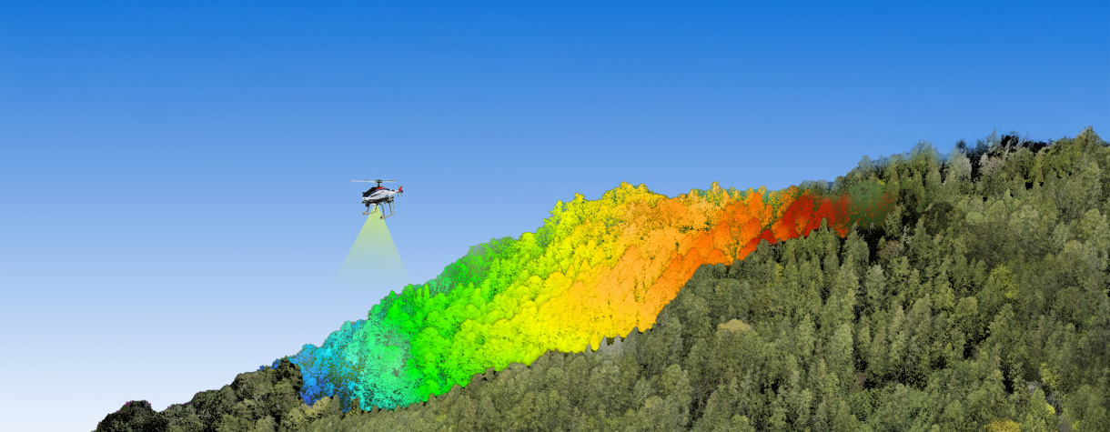
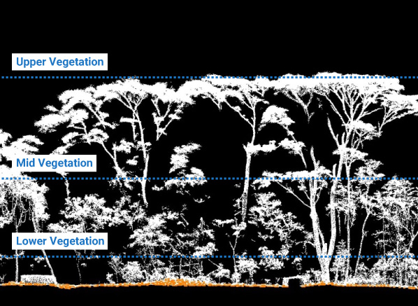
Through aerial LiDAR measurements using industrial unmanned helicopters, our Aero Sensing Services can reveal not only canopy but also understory and ground-level vegetation structures—even in dense forests. Because some laser pulses penetrate the canopy and reach the ground, it is also possible to accurately reproduce fine-scale terrain features.
Discovery of Ruins Beneath Dense Forest Cover
Even in forest-covered areas, aerial laser scanning can capture data that may lead to new archaeological discoveries. With high-resolution datasets, this technology supports not only the discovery of hidden sites but also more advanced and efficient archaeological analysis.
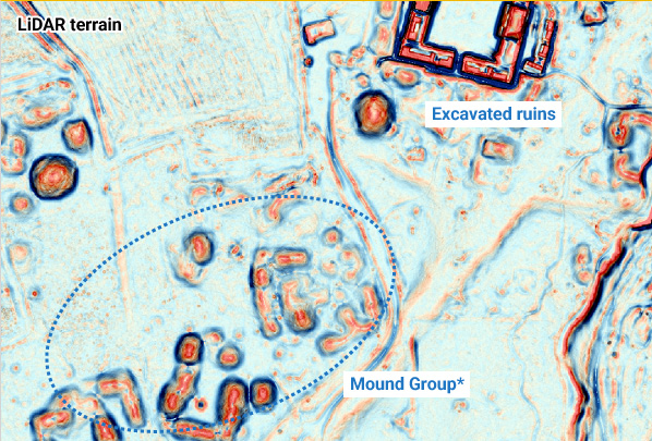
*Mound: An earthen mound containing buried ruins.
FEATURE 02
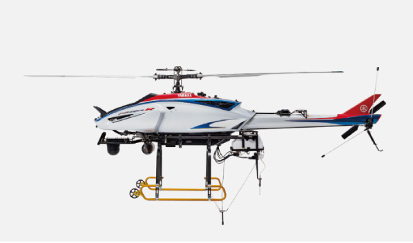
Wide-Area, High-Precision Data Collection Using Unmanned Helicopters
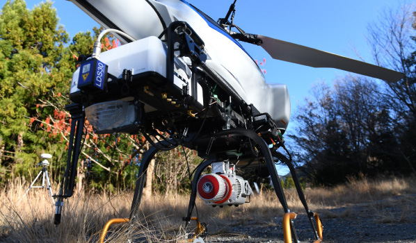
Yamaha Motor’s industrial unmanned helicopters, proven extensively in the agricultural sector, are equipped with state-of-the-art LiDAR systems offering industry-leading performance. By combining the helicopter’s mobility and flight control capabilities with advanced sensing technology, we deliver highly accurate and efficient surveying across large forest areas.
FEATURE 03
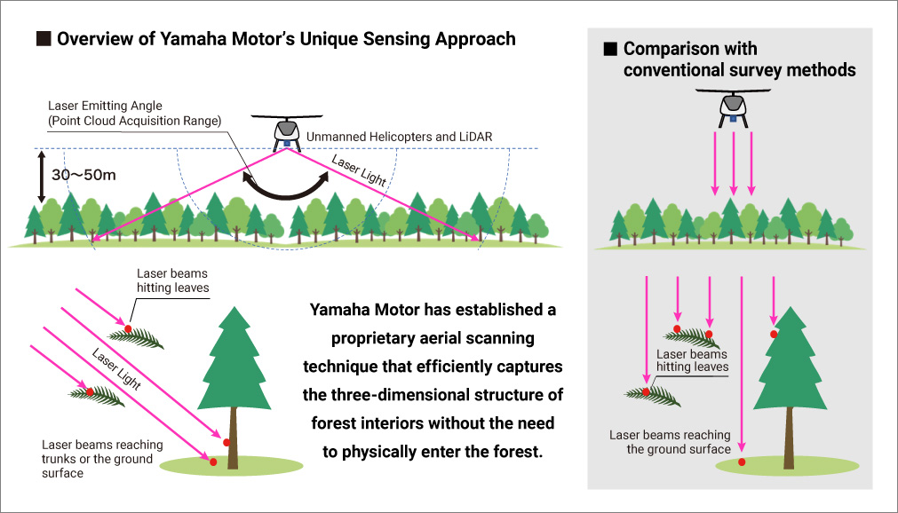
Low-Altitude, Low-Speed Flight with Wide-Angle Laser Scanning
Leveraging the flight performance of industrial unmanned helicopters, we conduct stable, long-duration flights over target forests. By flying at low altitude and low speed while following the terrain and emitting wide-angle laser pulses, Yamaha Motor has developed proprietary sensing technology that enables a large number of laser beams to penetrate deep into the forest. This allows us to capture point cloud data that reveals detailed terrain and forest structures using aerial measurements alone.
Key Application Areas

- Supports new discoveries and advanced research at archaeological sites hidden beneath dense jungle.

- Helps prevent and reduce windthrow damage, identify hazardous areas within forests, and support restoration planning.

- Enables data acquisition for MRV (Monitoring, Reporting, and Verification) to support the generation of carbon credits.
- Supports resource assessment, boundary agreement processes, and virtual site inspections, reducing labor requirements.